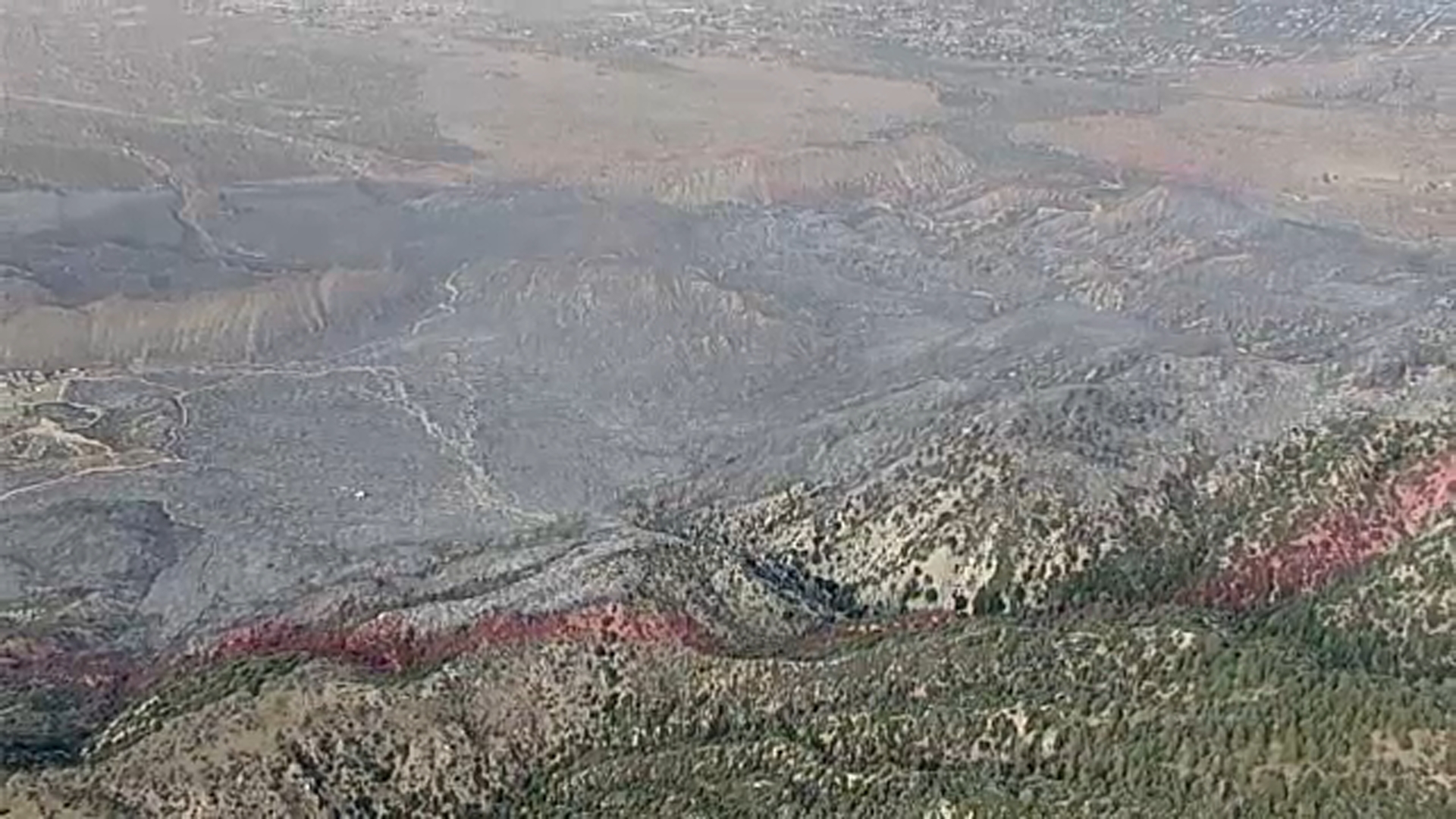
The Summit Fire burning in the Antelope Valley, more than 60 miles north of Beverly Hills, reached 8% containment by Saturday evening, July 11, after growing to approximately 2,690 acres, according to Cal Fire.
For canyon residents in Bel Air, Holmby Hills, and Beverly Hills, a separate concern hits closer to home: the National Weather Service forecasts a 10% to 20% chance of dry lightning in Los Angeles County mountain areas, including the Santa Monica Mountains, from Sunday, July 12, through Thursday, July 16.
What canyon residents should know
Much of Bel Air and portions of the Beverly Hills hillside fall within Very High Fire Hazard Severity Zones. Under LAFD Ordinance No. 177215, a Red Flag Day declaration automatically activates parking restrictions in those zones. Restrictions run in 24-hour periods from 8 a.m. to 8 a.m. the following day, and vehicles parked in violation on narrow roads, sharp curves, or key intersections can be towed.
A Red Flag Day is declared when wind speeds reach 25 mph or greater and humidity drops to 15% or less, or when the National Weather Service issues a Red Flag Warning for the City of Los Angeles.
The Los Angeles County Department of Public Health issued a Smoke Advisory through 5 p.m. Saturday, July 11, for portions of the county affected by Summit Fire smoke.
Residents can check current Red Flag status and restricted parking areas at ers.lafd.org/redflag. For general emergency preparedness information, visit beverlyhills.org/fire or lacounty.gov/emergency.
Summit Fire details
The fire ignited at approximately 12:49 p.m. Friday, July 10, near Jesus Canyon Road and East Avenue Z in Llano. It crossed into Angeles National Forest that afternoon and triggered evacuation orders in the Llano area. One residence was damaged and one outbuilding was destroyed, the Los Angeles Times reported, citing an incident update. No injuries have been reported.
The blaze had zero containment when first measured Friday night at 2,677 acres, according to Angeles National Forest officials. By Saturday evening it had grown slightly but crews began gaining ground.
An incident update warned that the potential for rapid fire growth with erratic fire behavior remained high as of Saturday, July 11.
Why the lightning forecast matters locally
Dylan Flynn, a meteorologist with the National Weather Service in Monterey, said the monsoonal pattern could produce "lightning without the rain that could put out any fire starts." The lightning risk concentrates in mountain terrain, the same ridgelines that border Bel Air and the Beverly Hills canyons directly.
Spencer Fielding, a meteorologist with the National Weather Service in Oxnard, said the lightning window runs from Sunday through Thursday and covers Los Angeles, Ventura, Santa Barbara, and San Luis Obispo counties.
The forecast arrives on the heels of a heat wave that pushed non-coastal Los Angeles County areas 10 to 15 degrees above normal and dried vegetation across the region. A second Antelope Valley blaze, the 188-acre Juno Fire near Lancaster Road, also burned Saturday before evacuation warnings were lifted that evening.
Updated containment figures from Angeles National Forest and Cal Fire are expected as crews continue work through the week.